[ad_1]
In 2015, the United Nations embraced a global call to action to protect the environment with a robust framework for global sustainable development. This motion birthed the Sustainable Development Goals (SDGs), a collection of 17 interwoven global goals carefully designed to balance social, economic, and environmentally sustainable development across the world by 2030.
The SDGs or Global goals were developed as a Post-2015 Development Agenda to improve the activities carried out in Millennium Development Goals, which ended in 2015. The global indicator framework for Sustainable Development Goals was developed by the Inter-Agency and Expert Group on SDG Indicators (IAEG-SDGs) and agreed upon at the 48th session of the United Nations Statistical Commission held in March 2017.
On July 6, 2017, the SDGs were made more actionable by a UN Resolution adopted by the General Assembly. The resolution identifies each goal and indicators that are used to measure progress toward each target. The timeline for each target is usually between 2020- 2030, while other targets are to continue in perpetuity.
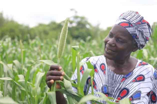
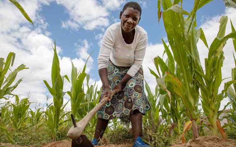
SDG 2 – Zero HungerSDG 2 aims to end hunger, increase food security, end malnutrition, and promote sustainable agriculture. This requires sustainable food production systems and resilient agricultural practices, land use mapping, disaster management, and international cooperation on investments in infrastructure and technology to boost agricultural productivity.The UN has since developed 14 indicators and eight targets to measure the progress of SDG 2, and these targets are then divided into the outcome targets and the methods of achieving the targets.
These methods include:
- Enhancing international cooperation in rural infrastructure; a substantive increase in investment enhances agricultural productive capacity, especially in developing and underdeveloped countries.
- Reforming and preventing trade restrictions in world agricultural markets; through the parallel elimination of all forms of agricultural export subsidies and all export measures with equivalent effect, following the mandate of the Doha Development Round.
- Adopting measures to improve the food commodity markets and their derivatives and facilitate timely access to market information to help limit extreme food price volatility.
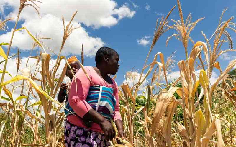
The number of people dying from famine is increasing rapidly, particularly in the sub-Saharan region. Since 2010, Africa has been the most affected continent in the world. This is due to the numerous challenges facing the continent – economic challenges, drought, extreme weather, etc.
On the African continent, 257 million people are experiencing hunger, which is 20% of the entire population.
- Chamisa under fire over US$120K donation
- Mavhunga puts DeMbare into Chibuku quarterfinals
- Pension funds bet on Cabora Bassa oilfields
- Councils defy govt fire tender directive
Keep Reading
According to the Global Hunger Index (GHI) 2020, three key indicators are used to calculate the GHI scores, ranging from 0-100. These indicators are; undernourishment, child underweight, and child mortality.
Chad has been a regular on the global Hunger Index since 2017. The ongoing effects of climate change in the country have contributed to widespread food insecurity, compounded by the influx of refugees from the conflict-torn Central African Republic, Nigeria and Sudan. At 44.7%, Chad’s undernourishment rate is the highest in this report, with a child stunting rate of 39.8%. This contributes to a mortality rate of about 12% of children under 5. This makes Chad one of the few countries in the world where more than 1 in 10 children dies before their fifth birthday.
Several African countries are not included in the GHI due to insufficient data to support their GHI scores. However, based on available data, it was estimated that the following countries would rank somewhere between Chad and Madagascar in terms of hunger levels: Niger, South Sudan. Uganda, Zambia, and Zimbabwe.
How space technologies can help achieve the mandate of the SDG-2In recent times, the adoption of Space-based technologies in precision agriculture has improved how farmers, agronomists, food manufacturers, and agricultural policymakers treat crops and manage fields to enhance production and profitability.
Crop BreedingSpace environment provides the means to uncover the hidden potential in crops, commonly referred to as space breeding. This involves combining agricultural sciences with astronautics. Seeds are sent into space via spacecraft. In the space environment, the seeds may undergo mutation, and after returning to Earth, mutated seeds are selected and planted to breed new varieties with overall improved qualities.The joint venture between the Food and Agriculture Organisation of the United Nation and the International Atomic Energy Agency (FAO/IAEA) Division of Nuclear Techniques in Food and Agriculture have ventured into some projects in this field.
The FAO/IAEA Mutant Variety Database documents the extensive use of mutation induction for crop improvement, including more than 3,346 officially released mutant varieties from 228 different plant species in more than 73 countries globally.
Also, over 1,000 mutant varieties of major staple crops – yam, rice, cassava, etc. cultivated on tens of millions of hectares enhance rural income, improve human nutrition and contribute to environmentally sustainable food security globally.
Furthermore, approximately 10kg of the Pokkali rice variety was sent into space by a Chinese spacecraft to observe heritable alterations in these seeds’ genetic framework and planting materials. These alterations were induced by the effects of cosmic rays, microgravity, and magnetic fields in space. Upon return to Earth, the seeds were planted in the greenhouse at the FAO/IAEA Agriculture and Biotechnology Laboratory in Seibersdorf, Austria, to evaluate viable seeds with overall improved quality.
Biodiversity and DesertificationEarth observation and characterization of agroecological zones is an essential asset for informing decision-makers. This is done by assessing the state of conservation of biodiversity for food and agriculture and estimating the health status of ecosystems, among other things.Satellite imagery can also provide essential data used for quantifying and modelling biodiversity. Space technologies can also provide additional value by integrating images and mapping abilities into existing information systems on genetic resources for food and agriculture.
The Weather Risk Management Facility, a joint initiative of the International Fund for Agricultural Development (IFAD) and the World Food Programme, started a research project on the use of satellite data to show when crop stress occurs on smallholder farms.
Ultimately, this data could enable the broader adoption of weather index-based insurance for farming households that lose their crops to severe droughts and other extreme weather events. Unlike traditional crop insurance, weather index insurance eliminates the need to track individual farmers’ crop losses. It allows for timely assistance that can help boost the resilience of rural people affected by desertification. In addition, satellite imaging is an essential tool that drives the decision of the UN Convention to Combat Desertification (UNCCD). They facilitate more effective action by providing reliable data about weather conditions and crop yields in regions at risk.
DroughtDrought, desertification and land degradation deprive people of food and water and force millions to leave their homes searching for greener pasture. The Drought Resilience Impact Platform (DRIP) helps prevent and minimize drought impacts on Ethiopia and Kenya’s local communities. It monitors the water supplies of three million people via sensors installed on groundwater pumps across hundreds of sites in both countries. The sensors alert the DRIP network if a pump is failing or needs routine maintenance. The DRIP team has developed models for groundwater demand using NASA Earth Observations satellite imagery, including data from satellite missions that use gravity to measure changes in water amounts on Earth’s surface.The Energy and Tenure Division of FAO uses composite imagery from Meteorological Operational Satellite-Advanced Very High-Resolution Radiometer (METOP-AVHRR) to monitor agricultural areas with a high likelihood of drought.
Flood controlMany African countries have adopted space technologies to give early warnings regarding the regions within Africa, which are peculiarly powerless against seaside disintegration and flooding.For example, the Space Climate Observatory has embarked on projects in lake Chad and Senegal to acquire more information and raise awareness among all concerned institutions of the impending dangers in the region. Data from satellites such as Copernicus, Sentinel 1, 2, 3, SPOT6-7, the Pleiades, and many others have helped achieve this.
Also, mapping floodplains and areas at risk of landslides with high-resolution satellite imagery and detailed elevation models can reduce the vulnerability or exposure of urban and rural populations across Africa.
Land-cover mappingLand cover and land-use mapping help to break down the different types of material on the earth’s surface. This information is vital for understanding changes in land use, modelling climate change extent and impacts, conserving biodiversity, and managing natural resources. The European Space Agency’s Climate Change Initiative (CCI) Land Cover project developed a map using high-resolution imagery from the Copernicus Sentinel-2. The resulting data and maps of status and trends help decision-makers formulate policies for sustainable development in rural areas.In-depth analysis of high-resolution satellite images improves real-time monitoring of crop vegetation indices for different fields and crops and identifies and monitors the dynamics of crop development. In addition to crop health, space-based applications provide inputs for comprehensive environmental and soil analysis. When these numerous techniques are compiled and integrated into decision-making models, specific agricultural interventions in particular field zones will improve.
Supplementary data- remotely sensed data is a critical component in the effective monitoring of agricultural production. Satellite imagery incorporated with field surveys allows the aggregation of areas planted and harvested during different crop seasons, and this earth observation data is now used to regularly monitor the crop season to improve productivity. – Space in Africa
[ad_2] Source link